2018年6月2日雅思写作机经小作文十三
来源 :中华考试网 2018-06-02
中2018年6月2日雅思写作机经小作文十三
参考题目13
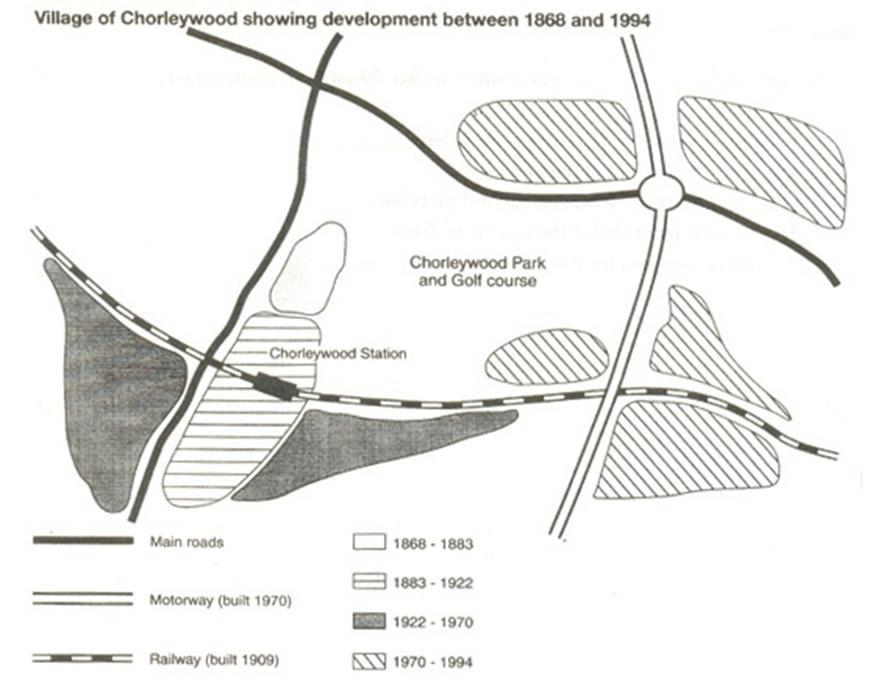
The map shows the development of the village of Chorleywood between 1868 and 1994.
图片
解题思路
【首段】总述图表显示Chorleywood从1868到1994年间的变化 【二段】总述在四个时间段里交通基础设施不断进步 【三段】分述1868-1883以及1883-1922两个时间段内交通进步 【尾段】分述1922-1970以及1970-1994两个时间段内交通进步
范文
The map shows the growth of a village called Chorleywood between 1868 and 1994. It is clear that the village grew as the transport infrastructure was improved. Four periods of development are shown on the map, and each of the populated areas is near to the main roads, the railway or the motorway. From 1868 to 1883, Chorleywood covered a small area next to one of the main roads. Chorleywood Park and Golf Course is now located next to this original village area. The village grew along the main road to the south between 1883 and 1922, and in 1909 a railway line was built crossing this area from west to east. Chorleywood station is in this part of the village. The expansion of Chorleywood continued to the east and west alongside the railway line until 1970. At that time, a motorway was built to the east of the village, and from 1970 to 1994, further development of the village took place around motorway intersections with the railway and one of the main roads.